Providing you with helpful websites to keep you up to date with travelling in the region and local events.
main roads
Main Roads can provide you with the latest on road closures and planning an efficient and safe trip to Meekatharra and beyond. Main Roads are responsible for the Great Northern Highway and the Goldfields Highway (Meekatharra-Wiluna Road) For more information visit their website.
department of fire and emergency
Check the latest bushfire warnings and updates to any areas you plan to travel at the Department of Fire & Emergency Services (DFES) – the government department that is responsible for fire and emergency services in Western Australia dfes.wa.gov.au and www.emergancy.wa.gov.au
If you plan to travel or stay near bushland, please be aware of potential risks that may occur during the bushfire season. Refer to the Bushfire Travellers Checklist from the DFES.
You can also check up-to-date news through Bushfire Information Hotline – call 1300 362 361
western australia's department of health
For more information and safety, updates visit https://ww2.health.wa.gov.au/
Surrounding Shire's
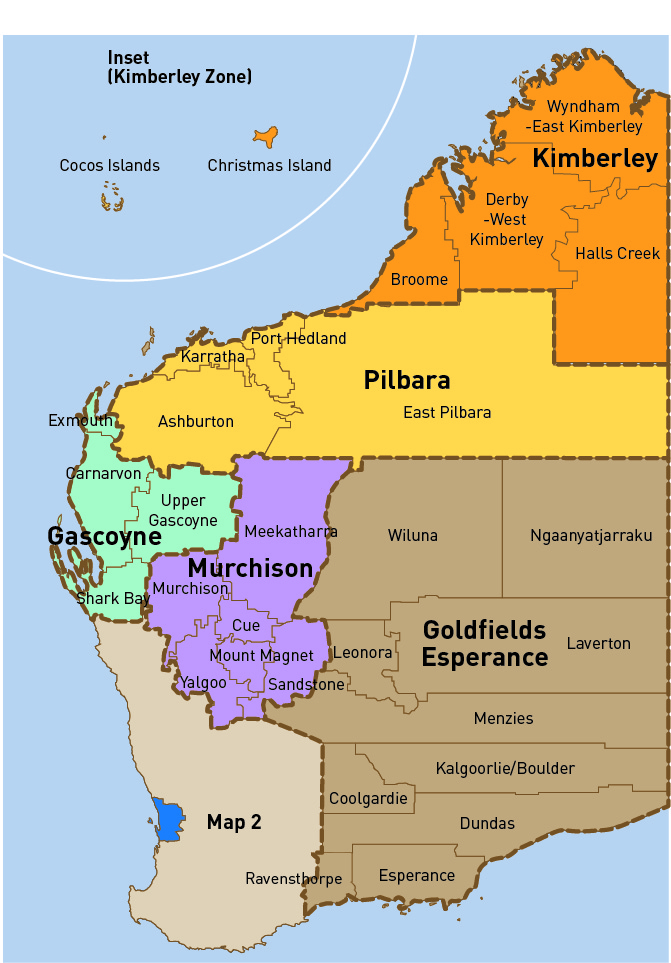
Meekatharra is surrounded by seven Shire's with the Murchison, Gascoyne, Pilbara and Goldfields regions of Western Australia. We have many roads that lead into other Shire's which are sometimes closed during extreme weather events. Make sure you check in with the other Shire's to see if the roads are open on their end.
Click on each Shire listed below to view their Road Condition Reports and while you are in the region see what other wonders this region has to show you.
Pilbara
Shire of Ashburton
Shire of East Pilbara
Goldfields
Shire of Wiluna
Murchison
Shire of Cue
Shire of Mount Magnet
Shire of Murchison
Gascoyne
Shire of Upper Gascoyne